Chances are, if you were asked six months ago what a low-traffic neighbourhood (LTN) was, you would have shrugged your shoulders and said, with rising intonation: “The Netherlands?”
That’s probably not the case now. The Covid-19 pandemic has forced government and local authorities to rethink the way we get around. With many people preferring to avoid public transport, LTNs are among measures designed to prevent a rush to private cars (and ensuing gridlock) by providing safe routes for walking, cycling and scooting – and they’ve become Big News around the country. However, LTNs have been around for much, much longer – and the world hasn’t ended.
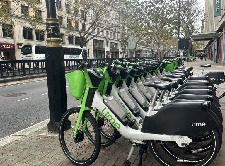
At its most basic, an LTN is a neighbourhood area where most or all through-traffic is kept to main roads using “filtering”, a method employing planters, lockable bollards or cameras to protect key residential streets. When connected with safe crossings, and linked to main-road cycle tracks, LTNs create a network of active travel infrastructure, where those on foot, scooters or cycles can travel through.
Meanwhile, motor vehicles – including emergency services – can still access every address, but they can’t cut between main roads. By making driving for short trips less convenient, and at the same time making walking or cycling feel safer and more pleasant with reduced traffic levels, LTNs tip the balance in favour of active travel for short trips.
Research shows LTNs cut motor traffic by 16%, including on the main roads surrounding the area. Recent analysis by the University of Westminster’s Professor Rachel Aldred found that not only do people walk and cycle more in low traffic neighbourhoods but, over time, car ownership drops, too.
Between 2000 and 2010 several of Exeter’s central shopping streets were closed to through traffic, and the pedestrian realm improved. Over the decade, footfall on those streets rose by 30%. Research by Transport for London found that improving cycling and walking provision resulted in more people sitting and waiting, with a 216% increase in activities such as going into a shop, stopping at a café or sitting on a bench. Nine out of ten business improvement districts in the capital said walking and cycling creates vibrant areas, and 83% said it attracts more customers.
Planters and bollards may seem humble tools with which to achieve such lofty ambitions but, according to walking charity Living Streets: “No intervention has been more effective in increasing active travel.”
With the rise in LTNs has come a seeming surge in concern about reallocation of through-routes from motor traffic to active modes, along with strident calls to rip them out and even vandalism. However, this isn’t the majority opinion: a survey by TfL found that 51% of people agreed with LTNs in their neighbourhoods, with just 16% disagreeing.
Here are ten low-traffic neighbourhoods that have been quietly working away across Britain for years, providing protected spaces for walkers, cyclists, wheelchairs, pushchairs, scooters and other low-impact travel. It may seem that people-first urban design and inclusive infrastructure need real bravery but, as cycling and climate-safe street designer Brian Deegan points out, “It’s just sensible planning.”
1: Hackney, London
Between 2000 and 2010, Hackney council embarked on an ambitious programme of neighbourhood filtering. The project worked: motor traffic in the borough halved (from 22.2% to 11.9% of all trips) while cycling levels more than doubled (from 6.8% to 15.4%).
Collision levels remained relatively high, however, a fact attributed to a lack of safe connections on main roads, such as pedestrian crossings, and lack of action over junctions, where most collisions take place.
The borough is rolling out three further LTNs as part of Covid measures, along with other solo traffic filters, and has now begun tackling main road routes and crossings.
2: Merton, London
There are 38 low traffic neighbourhoods across this South London borough, encompassing anything from a couple to twenty streets in each “cell” or area. The filters themselves are the traditional functional fare from the 1980s and 1990s – kerbs and lockable metal gates to permit emergency services – but they do the job. We are not sure how this scheme came about, but there aren’t any calls to remove them.
3: De Beauvoir estate, Hackney, London
On a popular cycling through-route from Hackney, and further east, into the West End, this is an LTN of many decades’ standing, called for by residents who protested against through motor traffic to protect children’s safety on roads. The bollards that remain today were, back then, called “filtered permeability” – in other words, rendering the streets permeable to some modes while filtering out through-trips by others. The area is now expensive to live in and forms a pleasant crossroads between North-South and East-West cycle routes.
4: Leicester
In the 1980s, anti-social crime and road danger blighted Leicester’s Highfields and Spinney Fields areas. Child road casualty rates soared as kids walking to school diced with traffic funnelled into the city by a 1970s road-building spree.
A government programme, known as Feet First, funded introduction of filters on Upper Tichborne Street and Bartholomew Street, in the Highfields neighbourhood. Elsewhere, Worthington Street was transformed by being modelled after the style of Dutch settings called Woonerf. This heavily-engineered intervention cost £250,000, a huge sum at the time, and wasn’t repeated elsewhere.
The area has escaped the gentrification sometimes associated with such schemes, a double win for renters or those looking to buy in the area.
5: Heptonstall
A steep, narrow cobbled street through the heart of this small West Yorkshire town – population less than 1,500 – makes through-traffic impractical, so visiting drivers are asked to park up and walk. Access is otherwise restricted, with few complaints. Thanks to its home on the long-distance Calderdale Way, it’s popular with walkers – and interesting for lovers of literature, as the author Sylvia Plath is buried there.
6: Edinburgh
Officials in Scotland’s capital started filtering the Georgian city-centre neighbourhood of Newtown in the 1980s and ’90s, as part of traffic management to cut rat-running on residential streets, and evolution has continued ever since. As Sustrans’ Daisy Narayanan puts it: “Making streets better for walking and cycling isn’t new”.
Neither is protesting change, it seems. Additional filters introduced to the city in 2005, with a new tram route, were removed after a campaign led by a local paper.
7: Grangetown, Cardiff
A 2018-19 project called “Greener Grangetown” planned to divert 40,000cu m of rainwater from the sewer network each year via a sustainable drainage system, or SuDS. Much of our Victorian sewerage systems also carry rainwater and, with growing populations and more extreme weather, can overflow after heavy rain. SuDS use attractive planting, in rain gardens, to draw and soak up surface rainwater and purify it, with added street beautification.
Along with planting, the project made improvements to the existing riverside pathway. Although the resulting “bicycle street” had already been filtered prior to the project, albeit with concrete rather than planting, it’s a good demonstration of how a range of sustainability interventions can work well in concert.
8: Old Town, Brighton
The narrowest streets of Brighton’s Old Town, now a popular boutique shopping area known as the Lanes, were closed to through traffic in 1989. In 2012, Brighton and Hove Council consulted on expanding pedestrianisation, with surveys showing 40% of through-traffic was travelling elsewhere.
A compromise saw some, but not all, proposed closures introduced. Steve Melia, UWE senior lecturer in transport and planning, wrote a paper on the programme and called such watering down “a lose-lose strategy, because you don’t get the wow factor”.
However, once implemented, residents broadly supported the changes, as business revenues increased and eateries introduced or expanded outdoor seating.
9: Exeter
Exeter’s Newtown was an area of run-down but structurally-sound Victorian houses. As part of regeneration works – cheaper than knocking them down and starting again – in the 1970s, the government provided the necessary funds to restrict through-traffic, plant trees and introduce playgrounds as well as car parks, with new blocks of flats erected in empty lots.
The film is worth a watch, if for nothing else than shots of people striding into the road without looking, even before filtering: it’s something today’s pedestrians wouldn’t dare do.
10: Cambridge
Part of Petersfield, to the east of the city centre, was made a low traffic neighbourhood in the 1980s, with just two gates that allow cycling and walking through-trips but not driving.
Martin Lucas-Smith, of Cambridge Cycling Campaign, says: “They really calm the whole area, removing through-traffic and seeing high levels of walking and cycling. Never heard any demand to let through-traffic back in.”
Arguably, Cambridge’s city centre is itself a low-traffic neighbourhood, as drivers are able to enter and exit, but not to drive through. Such measures, along with numerous parks, cycle lanes and other measures, combine to form a network of low-traffic routes that encourage cycling and walking.
“Don’t expect to get agreement in advance. You have to win the battle for hearts and minds after it happens and you need a brave political decision-maker to do that.”
Dr Melia, UWE
While the introduction of many low-traffic neighbourhoods prompts initial concerns from those using the streets, LTNs quickly become beloved schemes. Few local people would vote to return to through-routes for traffic.
As Dr Melia says: “The simple advice I have given to councillors and city leaders is: don’t expect to get agreement in advance. You have to win the battle for hearts and minds after it happens and you need a brave political decision-maker to do that. If you ran an opinion poll in Waltham Forest today asking, ‘Should we rip out the Mini Holland?’ [low traffic neighbourhoods], do you think you would get a majority for that? But if you did it beforehand, and said ‘Do you want to go ahead?’, you also wouldn’t have got a majority. It is the tyranny of the status quo.”
–
This article was updated on 07 October 2020 to correct De Beauvoir’s location from Islington to Hackney.


